
The journey to a sustainable future is a highly important one, not just across Scotland, but across the whole world.
Ahead of the upcoming COP26 meetings being held in Glasgow in November, we are running a weekly blog series exploring the role of technology in achieving net zero with our Technology Scotland members.
Across the coming weeks, we will be hearing from a wide range of our members on a variety of climate focused topics; taking a deep dive into some of the innovative products created to combat climate change with project focused blog pieces as well as thought-pieces where we will hear from industry experts on the future of technology and its potential applications as we move forward towards a more sustainable future. Plus lots more!
This week we’ve been chatting to Jason Rogers, Marketing Manager at Mapix technologies and Routescene to find out about their LiDAR technology.
Hello and thanks for kicking off our COP26 blog series. Tell us about your company and what you do?
Mapix technologies is a Scottish based company, established in 1996, with expertise in LiDAR. Under our Routescene brand we develop 3D mapping solutions using LiDAR technology. Our systems are used by customers around the world and we have an office in the USA to serve our primary market there.
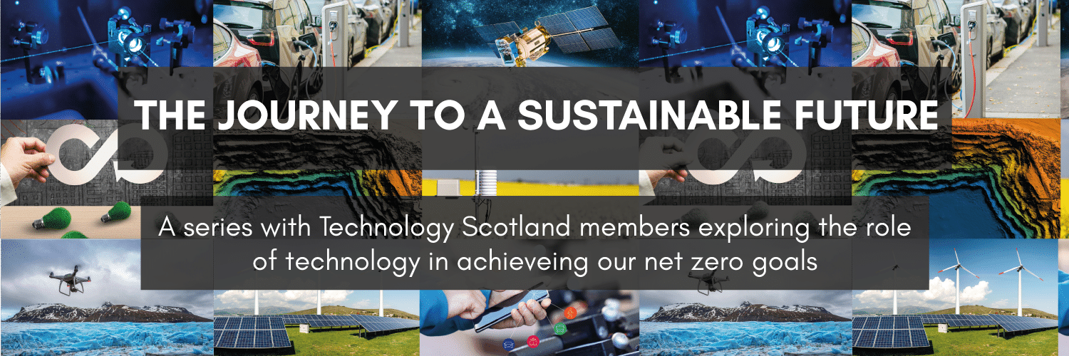
The Routescene UAV LiDAR system in flight
Can you outline your mapping systems for us?
Using our systems you can create high resolution 3D outputs including Digital Terrain Models and Digital Surface Models to study the landscape in detail. Developed for use on drones, the advantages are that you can safely survey sites which previously would have been too dangerous to access or too costly to perform such as cliffs and valleys with steep slopes or natural hazards such as landslides. With drone based LiDAR systems you can capture data much quicker than by conventional means and in greater detail. The systems are flexible and can be deployed on vehicles too which enables greater distances to be covered.
Can you explain what LiDAR is and why it is useful?
LiDAR, which stands for Light Detection and Ranging, uses lasers to measure the exact distances of objects. These pulsed lasers generate accurate 3D point clouds from which very precise measurements, models and maps can be produced. There are different types of LiDAR sensors used for different purposes – we use topological sensors for airborne (drone) and mobile (vehicle) applications.
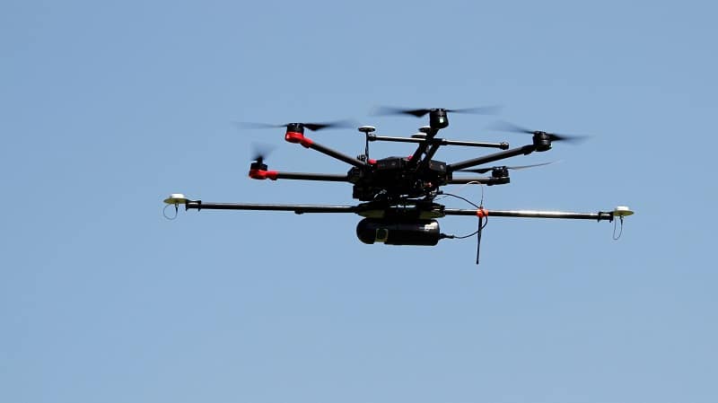
The Routescene LidarPod mounted underneath a drone
The great benefit that LiDAR has over other survey and mapping techniques such as photogrammetry, which only captures the canopy, is that it can penetrate through vegetation to the lower levels and the ground below. This feature lends itself to many environmental applications as you can build a comprehensive picture profiling the landscape and the terrain beneath.
Tell us more about the environmental applications?
Increasingly the news features dramatic weather events occurring across the globe such as heat waves, forest fires and flooding all linked to climate change. This year we have witnessed devastating fires in USA, Canada, Greece, Turkey and France and severe flooding in China, Germany and here in the UK too.
Our systems enable researchers, engineers, surveyors and foresters to understand the effects of extreme weather on the land. The results can inform future land management and enable options to be evaluated for disaster recovery planning.
Can you talk us through some specific projects your system has been used for?
Absolutely! Here are four case studies which illustrate how our systems are being used in earnest.
Researchers study the effects of climate change to improve modelling
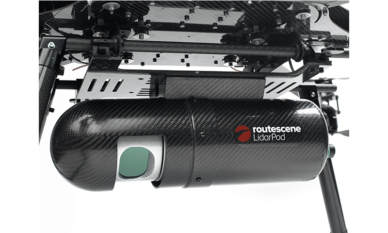
A team from the Los Alamos National Laboratory, New Mexico, USA mapped a remote area of arctic tundra in northern Alaska to measure the impact of climate change. As the permafrost warms the landscape is undergoing rapid change, resulting in vegetation shifts and the release of carbon dioxide and methane into the atmosphere (gases previously stored in the ground). Performed over two years this project contributed towards improving global climate model predictions.
The team in northern Alaska preparing to conduct a drone LiDAR survey
Forest survey to improve weather predictions
A team from the University of Wisconsin-Madison, USA used our UAV LiDAR system to capture highly detailed point cloud data of the dominant forest species in Northern Wisconsin. Due to the system’s outstanding vegetation penetration capabilities the team were able to detect and visualise the full tree structure of the forest. Characterising a forest enables researchers to better understand forest function and to study interactions between the land surface and the atmosphere. This data was impossible to gather by any other means. Ultimately these results will help to create policies which more effectively target reductions in carbon emissions and climate change.
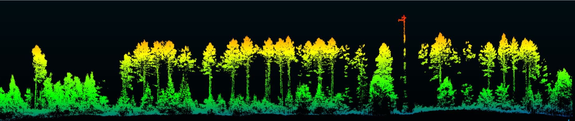
Detailed visualisations of the different tree species in Northern Wisconsin were created
Profiling forest fires to improve management and prevention
Wildfires don’t burn evenly through a forest. In a forested landscape some areas may be barely scorched, whilst in others the trees will be seriously damaged with branches and leaves fully burnt. The University of Toledo, Spain used the Routescene UAV LiDAR system to study how forest fires burn through vegetation. Using the high resolution point cloud data they profiled the forest from the canopy through to ground level, identifying individual trees and assessing specific metrics including crown leaf area density and tree height. This data is not attainable using satellite-based imagery. This study allowed the team to understand fire risk, fuel loads and will help create post-fire management plans.
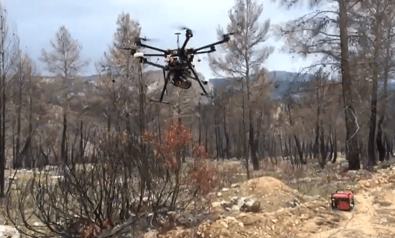
The Routescene UAV LiDAR system surveying woodland areas damaged by forest fire
Wildfires don’t burn evenly through a forest. In a forested landscape some areas may be barely scorched, whilst in others the trees will be seriously damaged with branches and leaves fully burnt. The University of Toledo, Spain used the Routescene UAV LiDAR system to study how forest fires burn through vegetation. Using the high resolution point cloud data they profiled the forest from the canopy through to ground level, identifying individual trees and assessing specific metrics including crown leaf area density and tree height. This data is not attainable using satellite-based imagery. This study allowed the team to understand fire risk, fuel loads and will help create post-fire management plans.
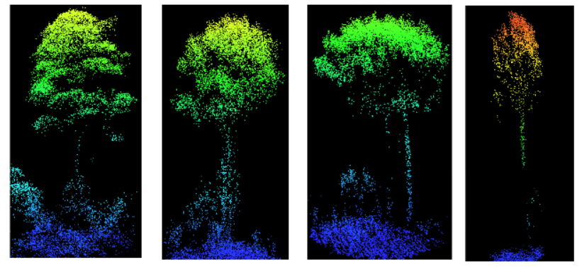
Routescene UAV LiDAR different tree profiles from forest fire
Monitoring landslides to plan land use
The Routescene UAV LiDAR system was used to repeatedly assess a landslide in the steep sloped Welsh village of Ystalyfera, UK to identify properties at risk. Using a drone based system allowed the survey to be conducted safely without personnel having to access the hazardous slopes. This project enabled the location and scale of ground movements to be considered. The local authority used the findings to evaluate options which led to some residents leaving their homes permanently and the abandonment of the local school to ensure their safety.
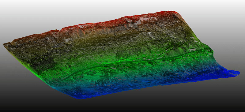
Digital Terrain Model with all the vegetation digitally removed of the landslide area of Ystalyfera, Wales
What do you see is the future for your technology?
Due to the specific benefits that UAV LiDAR data offers we anticipate that demand will flourish. The volume and detailed nature of the point cloud data lends itself to the detailed analysis of the effects of climate change. And as the rate of climate change increases so will the need for more regular surveys to monitor the land, to enable better modelling, to inform disaster remediation and to enable better land management.
For example, in the UK alone there are more than 5 million homes in danger of flooding and that risk will rise as the climate continues to change. An IPCC report suggests the sea level may rise by half a metre but a rise of 2 metres by the end of the century cannot be ruled out. Over the next six years in the UK £5.2bn is to be spent on building 2,000 new flood defence schemes.
Our technology can be used to assess the impact of weather changes from increased rainfall, by monitoring flood plains and landslides; increased temperatures, to prevent and manage forest fires; to coastal and river erosion.
For more information on the Routescene UAV and vehicle LiDAR systems and software please visit https://www.routescene.com/
Are you a member of Technology Scotland and are interested in being involved in our blog series? Get in touch with [email protected] to find out more.


